Lines of Code
| Author | Changes | Lines of Code | Lines per Change |
|---|---|---|---|
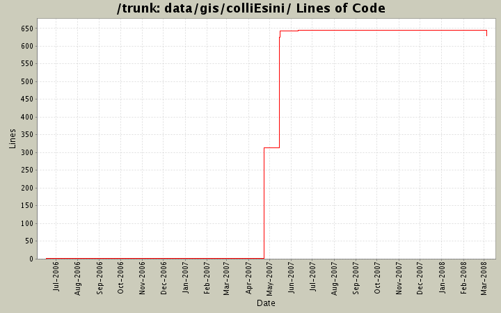
| Totals | 19 (100.0%) | 1880 (100.0%) | 98.9 |
| antonello.regmas | 15 (78.9%) | 1879 (99.9%) | 125.2 |
| lobianco | 4 (21.1%) | 1 (0.1%) | 0.2 |
Due to a server reset all CVS activity between 20070619 and 20080226 has been lost.
However, individual "steps" are still available as back-ups.
629 lines of code changed in 6 files:
Replaced with the original map with data before the filtering.
There was an error and the previous maps was with the corine land use data already filtered, this is why the filter was never coming into action!
294 lines of code changed in 1 file:
Added the local novalue indicator.
2 lines of code changed in 2 files:
Not used by the program, but usefull if need to use GRASS, as it contain geographical details about the region.
18 lines of code changed in 1 file:
Removed as switched to GRASS/ARC ASCII formats.
0 lines of code changed in 1 file:
adjusted on real 100meters by pixel (removed distorsion)
312 lines of code changed in 2 files:
Added the first original version of the admin borders dataset
312 lines of code changed in 1 file:
added the corin land cover map of colli esini as a simple ascii file ArcInfo ascii grid format, but headers seems slightly different)
312 lines of code changed in 1 file:
re-added as binary file
0 lines of code changed in 1 file:
removed to re-add it in a binary format
0 lines of code changed in 1 file:
Initial revision
1 lines of code changed in 2 files: